How to Navigate
Draw rectangle on map to select stations, zoom in/out to focus on regions, then click on the station in the sidebar to see realtime slant TEC. Station background noise level from the last 24 hours is shown as (
Data Availability
Near-real-time TEC data from GUARDIAN are available through the NASA Crustal Dynamics Data Information System (CDDIS)
Legend

GPS

GLONASS

GALILEO

BEIDOU

Earthquake

USGS Tsunami Watch

GDGPS Station
Archive
Explore Examples
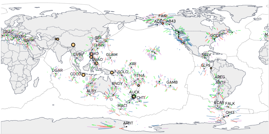
2025 Kamchatka Earthquake and Tsunami
On July 29, 2025 at 23:25 UTC, a Mw 8.8 earthquake off the coast of the Kamchatka Peninsula (Russian Federation) triggered a significant tsunami in the Pacific Ocean.
VIEW EXAMPLE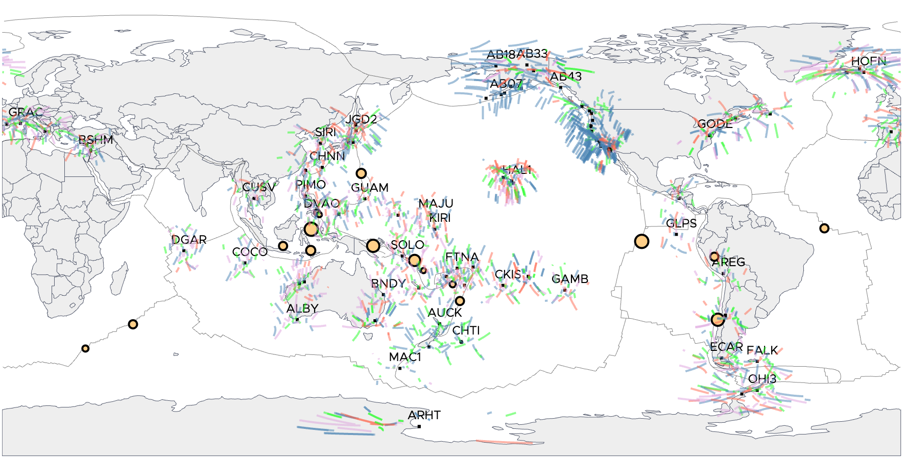
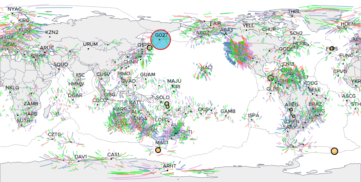
2024 Gannon Geomagnetic Storm
On May 10-13, 2024, the most severe geomagnetic storm (Kp ~9) since 1989 impacted Earth, triggering severe ionospheric disturbances. These disturbances are visible in the noise in TEC time series around the world.
VIEW EXAMPLE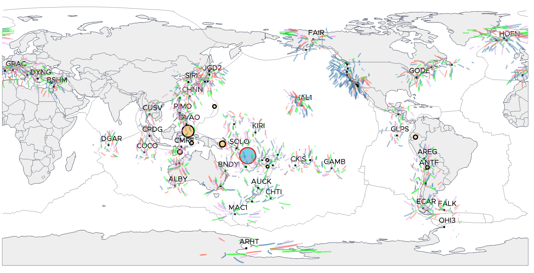
2023 Vanuatu tsunami
On November 22, 2023, a Mw 6.7 earthquake struck the Republic of Vanuatu and generated a small tsunami.
VIEW EXAMPLE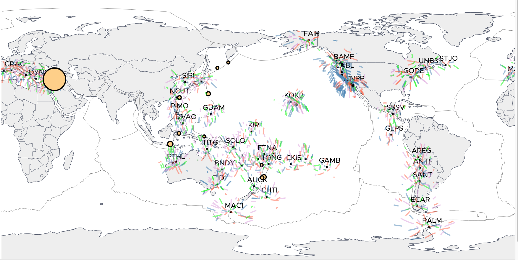
2023 Kahramanmaraş Earthquakes
On February 06, 2023, two high-magnitude earthquakes (Mw 7.8 and 7.5) struck the Kahramanmaraş region (Republic of Türkiye), leading to more than fifty thousand deaths in the Republic of Türkiye and Syria.
VIEW EXAMPLE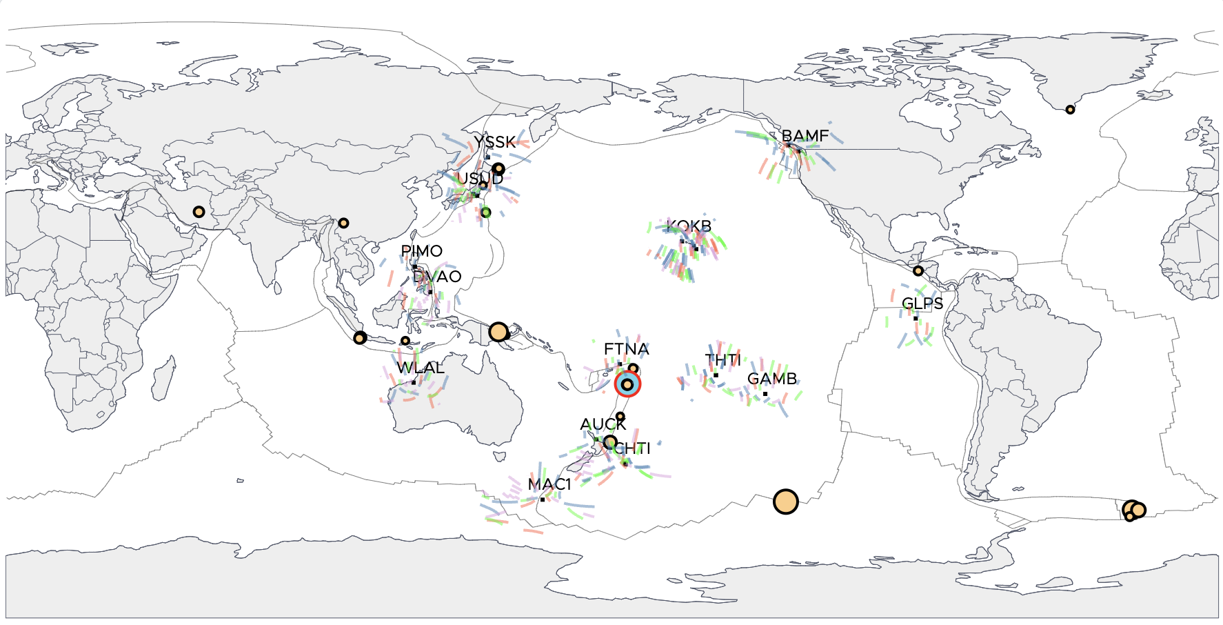
2022 Hunga Volcano Eruption
On January 15, 2022, the Hunga volcano on the islands of Hunga Tonga and Hunga Ha'apai erupted, producing the largest ionospheric signal ever observed. Atmospheric waves produced by the eruption circled the globe several times.
VIEW EXAMPLE
Powered by the JPL Global Differential GPS (GDGPS) System